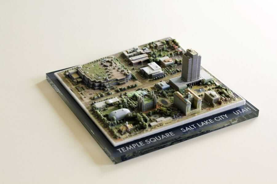
Source: reddit, amishrefugee
The Reddit user “amishrefugee” together with his colleagues managed to print full color models directly from Google Earth. To avoid the copy protection they only used the scan method photogrammetry.
Easier Than Expected
In photogrammetry, optical images of an object are taken from different angles. A 3D point cloud is then generated from the images and then a 3D model is created.
“amishrefugee” and his colleagues simply collected the different image perspectives of Google Earth, almost as if they had a drone on site. The collected data was then fed into a photogrammetry tool and used to convert the selected district into a 3D model. What’s practical: With only a few exceptions, Google’s 3D images are often very detailed and almost photo-realistic, so that the 3D model created can be printed out as a full-color city model using a standard 3D printer.

Source: reddit, amishrefugee


